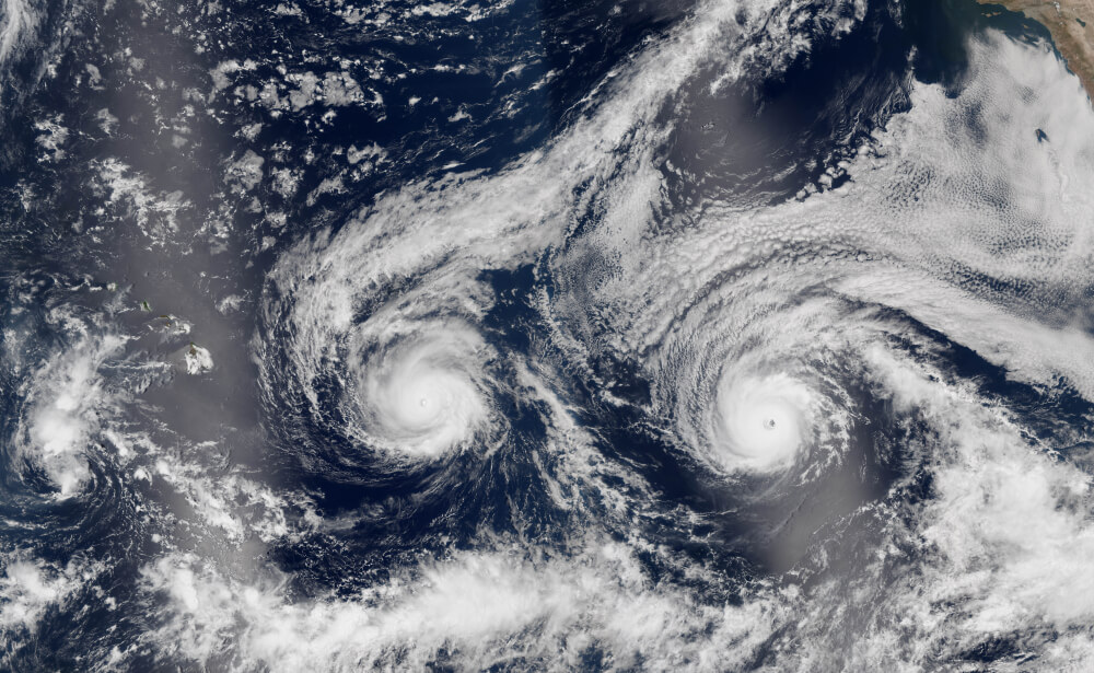
Strong winds, snowfalls and rains: two powerful storms will fall on 11 US states
Severe storms left the southern United States, where up to 7 inches (177,8 mm) of rainfall and flooding occurred in parts of Carolina and Georgia: on March 5, some streets in downtown Charleston, South Carolina were impassable due to heavy rain, ABC News. Now the weather threatened another 11 states.

Photo: shutterstock
The storm will now move along the east coast and join another storm that moves from the Great Lakes and possibly bring rain and snow to the northeast and some regions of the east coast.
On the subject: Rescue Tips: How to Survive a Tornado
On Friday, March 6, when these storms meet on the east coast, 11 states from Wisconsin to Georgia and Massachusetts are likely to be covered by strong winds and snow.
Both storms will unite by Friday evening, March 6, in the northeast, forming a strong storm off the coast. This new storm system could cause short-term snowfall in West Virginia, North Carolina, southeast New England, and eastern Long Island.
In the mountains of West Virginia, up to 10 inches (254 mm) of snow is expected in some areas.
On Saturday morning, March 7, snow will fall in most regions, and gusty winds are expected on the east coast. In coastal Massachusetts, gusts can reach 65 mph (104,6 km / h).
After the storm, warming is expected to reach 70 degrees Fahrenheit (21 Celsius) in some regions of the Midwest and Northeast.
In anticipation of a powerful storm, which is expected to cause strong gusts of wind, floods and snow on March 6 and 7, storm warnings have been announced in parts of eastern Massachusetts, reports Whdh.
The National Weather Service issued a strong wind warning for parts of Barnstable, Dewkes, and Nantucket counties from 9:00 a.m. March 6 to midnight March 7. According to meteorologist Josh Wurster, gusts of up to 65 mph (104,6 km / h) are expected on Cape Cod.
In Essex and Plymouth counties, the wind speed will be 20-30 mph (32-48 km / h) with gusts of up to 55 mph (88,5 km / h). Possible fall of trees and breakage of power lines, and therefore widespread power outages are expected. Traffic on the roads will be difficult.
From 6:00 a.m. to 11:00 a.m., Saturday, March 7, Barnstable, Dews, Plymouth, and Nantucket counties have warnings about flooding that may occur during high tide.
“If you must travel anywhere, please be aware that roads may be closed due to the possibility of flooding, so time your journey carefully. Do not attempt to avoid obstacles or cross water of unknown depth. It is also recommended to take the necessary measures to protect property,” meteorologists advise.
Snow warnings apply to Barnstable, Dewkes, and Nantucket counties from 20:00 p.m. March 6 to 11:00 a.m. March 7.
Barnstable and Dukes counties could see 2 to 4 inches (50-127 mm) of snow, and Nantucket could see 3 to 6 inches (76,2-152,4 mm) of snow. Motorists are advised to be careful on the roads.
On March 6 and 7, a cold atmospheric front in the San Francisco Bay area will bring light rain to this region, ending the drought that lasted 37 days. The second storm will hit the region by the evening of March 8, reports MSN.
On the subject: Dozens of victims, ruined homes, and power outages: disastrous effects of a Tennessee tornado
According to forecasts, the first storm system will be in the northern part of San Francisco Bay on the evening of Friday, March 6, and then slowly spread to the south, reaching Monterey Bay by Saturday morning.
In the area of the San Francisco Bay on March 7, heavy rain will pass in the morning, during the day the precipitation will be insignificant.
The storm system will lead to lower temperatures in this region in the afternoon of March 7. March 8 precipitation is not predicted. But from Monday, March 9, rains will begin.
Heavy rainfall is expected along the Big Sur coast. 1-2 inches (25-50 mm) of precipitation is forecast here. The rest of the coastal areas will see one to two tenths of an inch (2,5 to 5 mm) of rain, with the East Bay hills getting a half inch (12 mm).
Read also on ForumDaily:
Powerful tornadoes hit Tennessee: there are dead
List of names and forecast for hurricane season 2020 unveiled
'I saw a tornado with my own eyes': how a Russian-speaking immigrant survived a hurricane in Florida
Subscribe to ForumDaily on Google NewsDo you want more important and interesting news about life in the USA and immigration to America? — support us donate! Also subscribe to our page Facebook. Select the “Priority in display” option and read us first. Also, don't forget to subscribe to our РєР ° РЅР ° Р »РІ Telegram and Instagram- there is a lot of interesting things there. And join thousands of readers ForumDaily New York — there you will find a lot of interesting and positive information about life in the metropolis.


