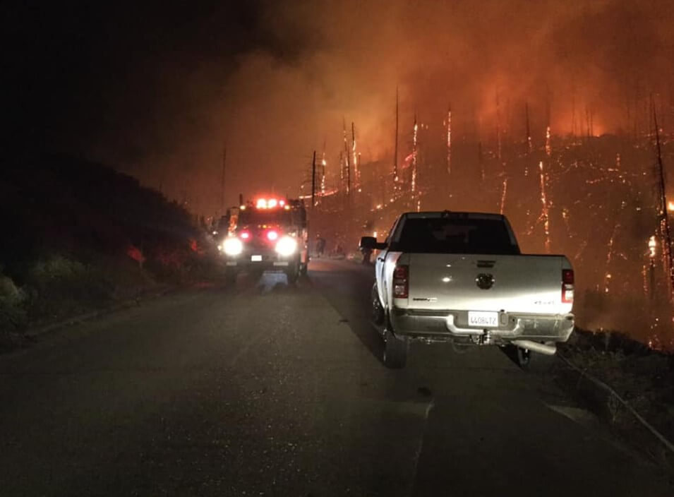
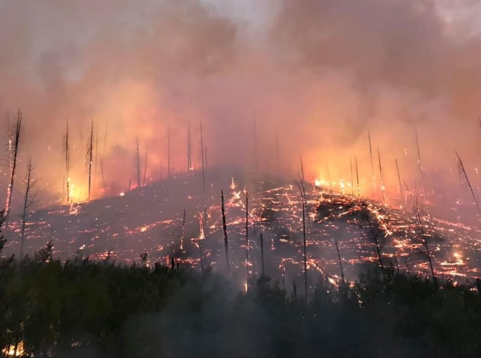
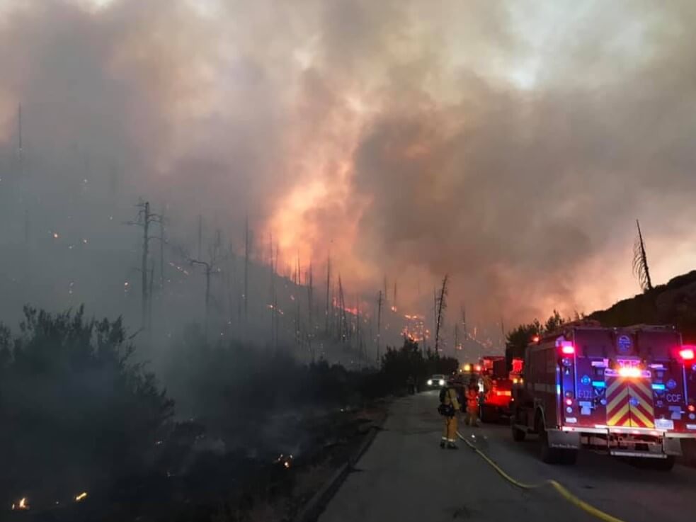
More than 10 forest fires in California: what and where it burns, and what residents should prepare for. PHOTO, VIDEO
Almost every day in September, new forest fires in California are reported. We have collected the most relevant and important information to help you keep abreast of events and stay safe.
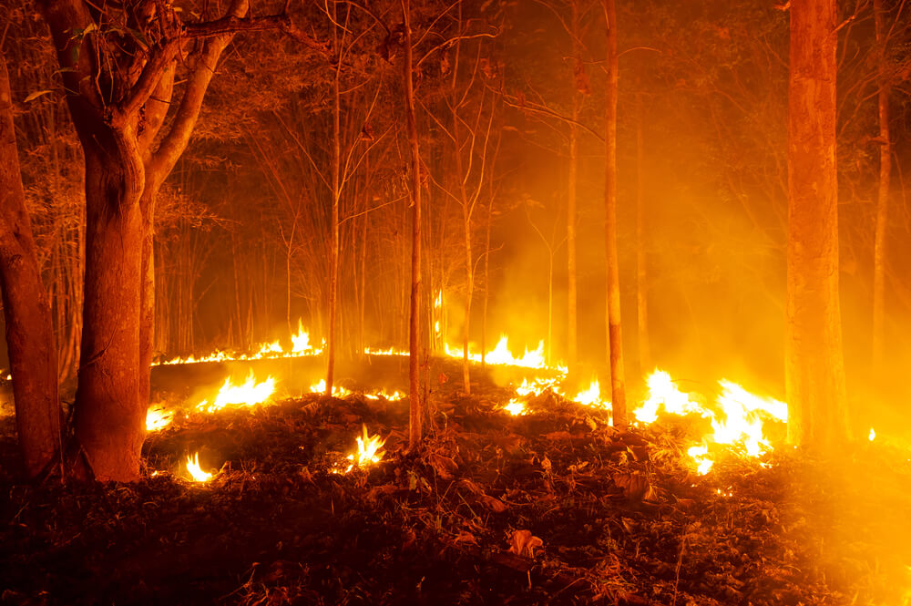
Фото: Depositphotos
How to keep track of fires
Here are the interactive maps that you can follow to receive California fire updates in September. Often, to get the most up-to-date information, it’s worth looking at all the maps, because fires do not always coincide with the rate of data update, writes Heavy.
One of the best interactive maps is Inciweb, its full version can be seen at this link. Also works embeddable google map, which also includes fire localizations according to Inciweb. Depending on your browser and its settings, you may need to zoom in using the "+" button on the map, or change your settings to only show fires from Inciweb.
Another convenient card offers Ca.gov. By following the link, you can enter your address to see how close the fires are to your location.
Please note that new fires are not indicated on these maps until a few hours have passed since the fire.
Another Embedded Interactive Fire Map Provided UCANR.edu. This map is updated only twice a day, so it may not be as relevant as the two above-mentioned interactive maps.
Active fires as of September 15 2019
Organized fires are worth mentioning as a separate category: these are fires that are created purposefully for certain purposes by the local forestry or other authorized services and are fully controlled. Now such fires are taking place in the vicinity of Iriki, California.
So that you can quickly find a specific place of the fire, we listed them in alphabetical order.
Broder fire
A fire of 381 acre (154 ha), controlled at 70%, started from the August 8 lightning and is located northeast of Broder Midow. Fire spreads moderately and there may be smoke in the region.
Cow fire
The fire has burned 1975 acres (799 hectares) and is 30% under control. The fire started suddenly on July 25. The affected area includes the Inyo National Forest and Golden Trout Wilderness. On September 7, the danger warning was updated, with authorities advising people to avoid the area. It later became known that the fire was successfully controlled, but more precise figures have not been published.
On the subject: Dry and windy weather in California threatens new forest fires
Fork fire
The fire started on September 8 in the early evening and was caused by lightning. The area is Middle Fork Parker Creek in the South Warner Wilderness. The fire consumed 39 acres (15,7 hectares) of territory. Fire activity is reported to be very low and the fire is being successfully controlled.
Henthorne fire
The fire covered an area of 244 acre (98 ha), as of September 14 it was localized at 90%. The fire zone is located 15 miles (24 km) northeast of Kovelo in Mendocino County, near Lake Hentorn. The cause of the fire is being investigated.
Horseshoe Fire at Juniper Flats
The fire in Riverside County is 250 acres (101 ha); as of the morning of September 15, the fire was localized at 20%. It is located near the 21 000 block of the Stagecoach Trail.
Because of this fire on Saturday evening, September 14, 200 residents from 600 houses in the Mayberry community in San Jacinto received an order to evacuate from the Riverside County Fire Department, writes NBC Los Angeles.

Fire in San Jacinto. Photo: video frame nbclosangeles.com
On Sunday afternoon, orders for houses closer to the west of Warren Road and south of Mulberry Street were canceled. Residents returning home were advised to wait a bit to allow firefighters to deal with the fire.
So far, there have been no reports of damaged structures or human injuries.
The fire started on 10 acres (4 ha), but in a few hours it already covered 75 acres (30 ha), and then 100 (40 ha). In one night, the area doubled. To combat the flame, more than 200 firefighters arrived at the scene, as well as two air tankers and one helicopter.
The South Coast Air Quality Management District has notified the population of smoke, causing air quality in San Jacinto, Beaumont, Kalimes, Bunning and Cabazone. The warning is valid until mid-Monday.
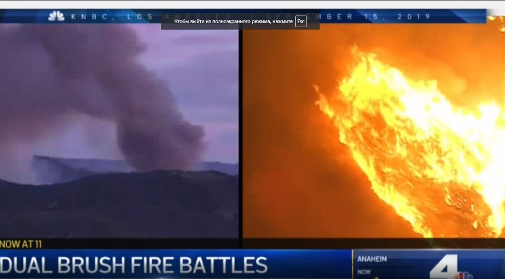
Fire in San Jacinto. Photo: video frame nbclosangeles.com
An evacuation center works on site. By this link Information to help you stay updated.
Kidder xnumx fire
A fire of 181 acre (73 ha), localized at 54%, was caused by lightning. It is located in the Marble Mountain Desert, west of Mount Etna, California. It is reported that the fire has minimal activity, but gives plenty of smoke around the perimeter.
KNF Lightning Fires
In the national Klamath as a result of strong storm winds of 11 and 12 of September, about 40 individual fires arose. Most of them are controlled and remain small, from 1 / 10 acres to 5 acres (2 ha). On-site fire brigades.
Lake View Terrace Fire Near Sylmar
On September 14, haystacks lit up on the 210 highway on Lakeview, as a result of a large-scale fire, traffic on all lanes in the western part of the highway was stopped. As of September 15, the fire was completely extinguished.
Lime fire
The fire started on September 4 due to a lightning strike, and by September 15 it was 84% contained and covered 1872 acres (757 ha). Location - Near Lime Gulch in the Klamath National Forest, west of I-5, north of Highway 96. By the evening of September 12, the Siskiyou County Sheriff's Office issued an evacuation order for residents potentially affected by fire and smoke. You can follow developments on Facebook и Instagram.
Lone fire
The fire occupies 5737 acres (2321 ha) and as of September 13 was localized at 95%, the fire is no longer considered active on the main maps. The outbreak was located in the Modoc National Forest in Modoc County, near Pinnacle Lake, in the Doublehead Ranger area. The fire provoked lightning.
On the subject: PG&E will pay $ 1 billion for the deadliest fire in California: the company has already filed for bankruptcy
Middle fire
The fire swept over an area of 575 acres (232 ha) a mile east of Canyon Creek Trail and was caused by lightning on 5 September. The fire moves down the slopes, so the fire is not expected to spread far. The nearest hiking trails were closed to full localization. Two firefighters suffered from the fire.
Ramshorn Fire / SHF Lightning Fires
A fire broke out on September 12 in the morning and occupied 280 acres (113 ha) in the Shasta-Trinity National Forest in Trinity County. Now it is localized on 100%.
South fire
The fire started in the Shasta Trinity National Forest in Tejama County, as of September 15, it spanned 4727 acres (1912 ha) and was localized to 20%. The outbreak is located 15 miles south of Platinum, California. The expected increase in wind may accelerate the spread of the fire.
On the subject: 1200 California people leave home due to forest fire in California
Springs fire
A 10-day update on the fire said it was 98% contained and had burned 4840 acres (1958 hectares). The fire broke out due to a lightning strike. An area 13 miles (21 km) from Lee Whinning was burning. Hiking trails and roads remained closed as of last update. Post-fire areas are still dangerous - visit the website for more information Inciweb or to page Facebook.
Taboose fire
The fire covers 9438 acres (3819 ha) and is localized at 59%. Burning area southwest of Big Pine and northwest of Aberdeen. The reason is being investigated. A strong wind persists along with the threat of accelerated spread of fire. Owens Valley residents are being warned to take extra care.
Tenaja fire
The area is 1926 acres (779 ha), as of September 14, the fire was localized at 100%. The fire started on September 4 near Tenenja Road and Clinton Kit Road in La Cross and the fire quickly grew, in just a few hours. You can learn more about this fire. here.
Walker Fire in Susanville
For the first time information about the fire appeared on September 4, its cause is unknown. By September 15, fire engulfed 53 186 acres (21 523 ha) and was localized to 67%. Burning territory east of Genesee, near Indian Creek and Beckworth Genesee Road, 11 miles (17 km) from Taylorsville. A warning about a possible increase in wind and a recommendation on a possible evacuation were issued. You can subscribe here for important updates or call 530-616-8625 to find out more.
California's biggest 2019 fire seen from space
From September 4, the Walker Fire expanded to 53 186 acres (21 523 ha) and was localized to 67%, making it California's largest forest fire this year, according to InciWeb and Yahoo News.
Fire engulfed parts of the Plamas National Forest. At the direction of the county sheriff, the areas of intersection of Murdoch and Stony are still under the mandatory evacuation order, although other areas where such orders were announced earlier remained under the influence of warnings of a recommendatory nature.
On September 8, the Landsat 8 image scanner photographed the Walker Fire with a combination of natural color superimposed on an artificial color composition to further emphasize burned-out areas, according to NASA.
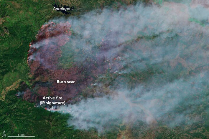
"Fire crews will get some help from nature on Monday with some rain coming to Northern California," said AccWeather meteorologist Renee Duff. “This will be the first measurable amount of precipitation since late May for Sacramento.”
Now more than 2000 people are involved in containing the fire.
In addition to rain, gusty winds await the region, so flames can swell and spread, causing an unpredictable movement of a forest fire.
California's only largest recorded fire was the Rancho Fire, which burned 410 203 acres (166 000 ha) of territory in 2018. It became part of the larger Mendocino Complex Fire along with the River Fire. This combination turned into the largest recorded fire complex in history, in which 459 123 acres (185 800 ha) of land were burned. Rancho Fire was caused by sparks flying from a hammer driving a metal stake into the ground.
Read also on ForumDaily:
Dry and windy weather in California threatens new forest fires
Caution Solar Panels: Tesla Systems Caused U.S. Fire
For the first time in human history: UN announces emergency climate
Subscribe to ForumDaily on Google NewsDo you want more important and interesting news about life in the USA and immigration to America? — support us donate! Also subscribe to our page Facebook. Select the “Priority in display” option and read us first. Also, don't forget to subscribe to our РєР ° РЅР ° Р »РІ Telegram and Instagram- there is a lot of interesting things there. And join thousands of readers ForumDaily New York — there you will find a lot of interesting and positive information about life in the metropolis.


-
Personal experience: who and why you should not move to the USA5614
-
50 diseases whose presence will increase the cost of health insurance in the USA4329
-
Great opportunities with ChatGPT: 12 easy ways to make money using artificial intelligence1324
-
What should not be on your resume if you want to find a job in the USA763
-
Four unforgivable mistakes immigrants make to the United States552
-
Dependence on cars and one supermarket per city: why ours is unusual in one-story America403
-
Ten secret restaurants in the USA: what is their highlight and how to find them254
-
Personal experience: who and why you should not move to the USA5614
-
Where in the USA to buy the medicines we are used to: a list of pharmacies5330
-
How to hit the jackpot: tips from a man who won the lottery 7 times4898
-
50 diseases whose presence will increase the cost of health insurance in the USA4329
-
Street, avenue, boulevard or drive: how to understand the classification of US streets and roads1461
-
Personal experience: what not to do in America1402
-
Great opportunities with ChatGPT: 12 easy ways to make money using artificial intelligence1324