3 tropical storms rage simultaneously in the Atlantic: this is not a normal picture for June
Three tropical storms rage simultaneously in the Atlantic. This is unusual for June. Why, the publication said NBC Miami.
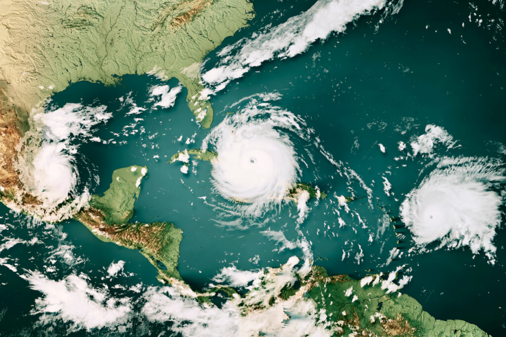
Photo: IStock
Satellite data shows three tropical storms lining up between the Caribbean and Africa, all moving west.
Bret came closest. It is near Barbados, between Martinique and Saint Lucia. Up to 10 inches (25,4 cm) of rain is forecast from Guadeloupe south to St. Vincent and the Grenadines with risk of flash flooding. Tropical storms are likely, with some islands still susceptible to hurricanes.
Bret is not expected to last long after passing the Lesser Antilles. The increase in wind shear caused by the drop in the jet stream should begin to weaken the tropical storm. It is possible that it will dissipate by the time it moves west across the central Caribbean between Venezuela and Hispaniola.
On the subject: Hurricane season 2023: a list of names and forecasts of storm activity in the Atlantic
Bret's hitting some of the Greater Antilles won't necessarily be a bad thing. El Niño, on the other hand, often leads to drought in the Caribbean Sea, and parts of the Dominican Republic and Puerto Rico are already quite dry.
Bret is followed by Tropical Storm Cindy, located midway between Cape Verde and the Windward Islands. Cindy's trail is predicted to lean more towards the open North Atlantic, meaning the storm is likely to bypass the islands entirely. Wind shear is also expected to play a role and Cindy is predicted to be unable to reach hurricane strength.
Typically, a third named storm in the Atlantic does not form until August 3rd. You could say we're six weeks ahead of schedule. This is largely due to the hot water of the Atlantic Ocean. Tropical cyclones need and get their energy from its warm water surface.
Another powerful tropical wave has formed off the west coast of Africa and has yet to be listed by the National Hurricane Center (NHC) as a candidate for a new depression or storm. But nothing can be said for certain.
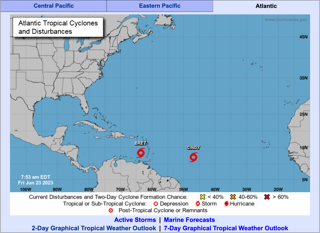
Screenshot: nhc
On September 1945, 15, Homestead, Florida was hit by a major Category 4 hurricane "sharing much in size, track, and impact with Hurricane Andrew of 1992," according to an NHC reanalysis of the 1941 to 1945 Atlantic hurricane seasons. .
Fortunately, there are some pretty big differences between the 1945 and 2023 seasons.

1945 was neutral, meaning the Southern Oscillation was out of phase El Niño, not in phase La nina. In 2023, we entered the El Niño phase, and this phenomenon is expected to become very strong by the fall. El Niño 2023 should result in many days when wind shear will limit the formation and strength of hurricanes.
Will another big difference between 1945 and 2023 come into play this season? In 1945, we were enjoying the last years of the Holocene epoch, which lasts approximately 12 years, when the climate became almost ideal for human flourishing.
Those days are over.
You may be interested in: top New York news, stories of our immigrants and helpful tips about life in the Big Apple - read it all on ForumDaily New York
A group of scientists argue that 2023 can already be considered part of the Anthropocene era. This period denotes a geological era in which the level of human activity plays a significant role in the Earth's ecosystem. One of the consequences of this role is global warming. At the same time, the number of scientists who agree with this statement is constantly growing.
The oceans have absorbed most of the heat trapped by increasing emissions of greenhouse gases produced by burning fossil fuels. And that's one of the reasons the tropical Atlantic is warming up so quickly.
Read also on ForumDaily:
How to Organize a Camping Trip in the USA: Useful Resources and Tips
How to hit the jackpot: tips from a man who won the lottery 7 times
Issuing non-immigrant visas to the United States has risen in price: new prices
How to prepare for admission to an American college: a step-by-step plan for a future student
How to make your children smarter: 10 scientific ways
Speak as a native speaker: 40 + English conversational expressions
How to effectively learn a foreign language if you are already an adult
Ten business tips from the richest people in the world
Subscribe to ForumDaily on Google NewsDo you want more important and interesting news about life in the USA and immigration to America? — support us donate! Also subscribe to our page Facebook. Select the “Priority in display” option and read us first. Also, don't forget to subscribe to our РєР ° РЅР ° Р »РІ Telegram and Instagram- there is a lot of interesting things there. And join thousands of readers ForumDaily New York — there you will find a lot of interesting and positive information about life in the metropolis.


-
Pros and cons of political asylum in the United States12868
-
Breathtaking: Must-Have Places in Southern California467
-
Top 15 most breathtaking caves in the world265
-
17 amazing things people decide to get a job0
-
A company in the USA will help everyone with paying rent in order to save them from fines0
-
Pros and cons of political asylum in the United States12868
-
Five dangerous mistakes when applying for a green card due to marriage4147
-
15 amazing professions you might not know about1313
-
A way to save in Target, which many do not know1034
-
What you need to know before you go on your first cruise812
-
Breathtaking: Must-Have Places in Southern California467
-
How to Fly Free: 10 Tips385
-
Pros and cons of political asylum in the United States12868
-
Personal experience: who and why you should not move to the USA5614
-
Where in the USA to buy the medicines we are used to: a list of pharmacies5330
-
How to hit the jackpot: tips from a man who won the lottery 7 times4898
-
50 diseases whose presence will increase the cost of health insurance in the USA4329
-
Five dangerous mistakes when applying for a green card due to marriage4147
-
Street, avenue, boulevard or drive: how to understand the classification of US streets and roads1461