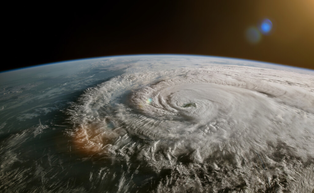
Hurricane Dora turned into a typhoon: this is only the second time in history
This week, Hurricane Dora made headlines for partly contributing to the winds that caused a ferocious firestorm in Hawaii. Now Dora, having already set the Pacific longest record, has made history more than three weeks after her birth, but in a different ocean. Now it's Typhoon Dora. Read more about this transformation told the publication The Washington Post.

Photo: IStock
Hurricane Dora became Typhoon Dora when it crossed the International Date Line in the Western Pacific late on August 11. It became the second storm on record to maintain hurricane strength in the eastern, central and western Pacific basins. Previously, Hurricane John, the longest-running tropical cyclone on record, made the same transformation in 1994.
The International Date Line is an imaginary line at 180 degrees of longitude that separates two calendar days and marks the boundary between the central and western Pacific Oceans. A tropical cyclone with a maximum sustained wind speed of at least 74 miles (119 km) per hour is called a hurricane in the central and eastern Pacific and Atlantic, and a typhoon in the western Pacific.
On the subject: Hurricanes, heatwaves and floods: which US cities are most vulnerable to climate change
Dora's journey began as early as July 17, when she first appeared as a cluster of clouds and showers (tropical wave) in the eastern Atlantic Ocean off the coast of Africa. From there, the tropical wave took a southerly route across the Atlantic and did not develop further due to the dry and stable air. After crossing Central America on July 28 and 29, the storm became stronger and more organized. Upon entering the eastern Pacific, it intensified into a tropical depression on July 31 and became Tropical Storm Dora on August 1, when winds reached 39 miles (62 km) per hour.
Traveling a total of nearly 10 miles (000 km), including 16 miles (093) across the Pacific, Dora became the longest-running Category 5 hurricane on record in the Pacific before weakening in recent days. Many meteorologists believe Dora-related low pressure contributed to the winds that quickly spread devastating wildfires across Hawaii this week, although there is some debate about what effect the storm had when it passed about 000 miles (9 km) to south of the Hawaiian Islands.
The passage of storms from the Atlantic to the Pacific is not unprecedented. Last year, both Bonnie and Julia made the jump from one ocean to another. For the first time, two storms in the same season maintained tropical storm intensity when they crossed the border.
However, most hurricanes coming from the eastern Pacific weaken once they reach the central Pacific due to cooler ocean waters, dry air and wind shear that increase with height and tend to tear storms apart. Dora, however, took on a more compact, donut-like shape known as a "ring" hurricane when it reached Category 4.
“This is important because ring tropical cyclones can wall off negative factors such as dry air or wind shear for longer. They tend to weaken more slowly than more common tropical cyclones,” explained meteorologist Jonathan Erdman.
You may be interested in: top New York news, stories of our immigrants and helpful tips about life in the Big Apple - read it all on ForumDaily New York
Due to the increase in shear, Dora will steadily weaken over the next few days, transitioning from a Category 1 typhoon to a low pressure zone with winds of just 35 miles (56 km) per hour, according to the Central Pacific Hurricane Center forecast. Remaining above open waters, the typhoon does not pose a threat to the land.
Record warm ocean waters likely contributed to Dora's longevity and her journey across two oceans. Those same warm ocean waters have prompted forecasters to increase the number of named storms they predict in the Atlantic Ocean this hurricane season.
As for the Pacific Ocean, Dora is not the only one being watched by forecasters. Typhoon Lan is a Category 4 storm in the Western Pacific that is forecast to hit Japan on August 14.
Read also on ForumDaily:
How to help victims of the fires in Hawaii: reliable funds
Rich, middle class or poor: how to understand if you have a high income in the US or not
Five features that cause culture shock after moving to the USA: personal experience
How to book a hotel with a discount using a VPN: tips and hacks
Why you can get dropped off a cruise ship
Top 10 profitable business ideas from ChatGPT: you can start without starting capital
Subscribe to ForumDaily on Google NewsDo you want more important and interesting news about life in the USA and immigration to America? — support us donate! Also subscribe to our page Facebook. Select the “Priority in display” option and read us first. Also, don't forget to subscribe to our РєР ° РЅР ° Р »РІ Telegram and Instagram- there is a lot of interesting things there. And join thousands of readers ForumDaily New York — there you will find a lot of interesting and positive information about life in the metropolis.


